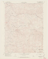
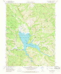
1967 Map of Crockett Peak
USGS Topo · Published 1969About this map
Snow Mountain dominates the high-altitude topography of this 1967 field survey, where the border of Lake and Colusa counties meets within the Mendocino National Forest. This section of the Inner Coast Ranges is defined by a network of seasonal drainages and remote peaks, including Crockett Peak and Signal Peak. The land use of the late 1960s is reflected in a system of utilitarian waypoints and campsites accessible by a primitive network of roads and trails.
Find a feature on this map
40 named features on this map. Tap any name to fly to it.
Don’t see what you’re looking for? This feature index may not catch every label — zoom into the map to look around manually.
Map Details
Editions of this 1967 Crockett Peak Map
4 editions found
Other maps of this area

1919 · Elk Creek
USGS Topo · 1:62,500

1922 · Hullville
USGS Topo · 1:62,500

1948 · Elk Creek
USGS Topo · 1:62,500

1951 · Lake Pillsbury
USGS Topo · 1:62,500

1951 · Stonyford
USGS Topo · 1:62,500

1952 · Hull Mountain
USGS Topo · 1:62,500

1957 · Elk Creek
USGS Topo · 1:62,500

1957 · Ukiah
USGS Topo · 1:250,000

1960 · Ukiah
USGS Topo · 1:250,000
1967 · Lake Pillsbury
USGS Topo · 1:24,000