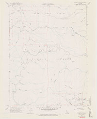
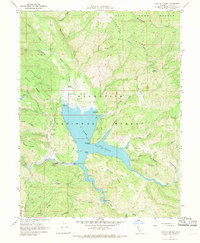
1967 Map of Crockett Peak
USGS Topo · Published 1969About this map
The Mendocino National Forest defines the rugged character of this California landscape during the late 1960s. High-altitude landmarks like Crockett Peak and the dual summits of Snow Mtn West and Snow Mtn East anchor the topography, where the Lake and Colusa county line follows the natural crest. Human activity is represented primarily by a network of seasonal routes, including a Jeep Trail and various Pack Trail segments that navigate the sharp drainage basins of the Eel River and Stony Creek.
Find a feature on this map
34 named features on this map. Tap any name to fly to it.
Don’t see what you’re looking for? This feature index may not catch every label — zoom into the map to look around manually.
Map Details
Editions of this 1967 Crockett Peak Map
4 editions found
Other maps of this area

1919 · Elk Creek
USGS Topo · 1:62,500

1922 · Hullville
USGS Topo · 1:62,500

1948 · Elk Creek
USGS Topo · 1:62,500

1951 · Lake Pillsbury
USGS Topo · 1:62,500

1951 · Stonyford
USGS Topo · 1:62,500

1952 · Hull Mountain
USGS Topo · 1:62,500

1957 · Elk Creek
USGS Topo · 1:62,500

1957 · Ukiah
USGS Topo · 1:250,000

1960 · Ukiah
USGS Topo · 1:250,000
1967 · Lake Pillsbury
USGS Topo · 1:24,000