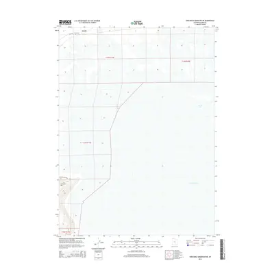
2014 Map of Crocodile Mountain NE
USGS Topo · Published 2014About this map
Kelton stands at the northern edge of this survey, a desert settlement located along the historic rail corridor on the flats north of the Great Salt Lake. This 2014 mapping reveals a landscape dominated by the salt flats and the expansive shoreline of Spring Bay, reflecting the arid geography of Box Elder County. The Kelton Cem remains a significant point for genealogists and local historians, serving as a primary landmark in a region where few structures endure. Transportation through this remote terrain is facilitated by Hogup Rd and Crocodile Mountain Rd, which navigate the transition from the mudflats to the rising slopes of the namesake landform to the southwest. The grid of township lines, including t12n r11w, highlights the geometric division of these vast public lands.
Find a feature on this map
10 named features on this map. Tap any name to fly to it.
Don’t see what you’re looking for? This feature index may not catch every label — zoom into the map to look around manually.
Map Details
Editions of this 2014 Crocodile Mountain NE Map
This is the sole edition of this map. No revisions or reprints were ever made.
Other maps of this area

1954 · Brigham City
USGS Topo · 1:250,000

1958 · Brigham City
USGS Topo · 1:250,000

1959 · Kelton Pass
USGS Topo · 1:62,500

1962 · Brigham City
USGS Topo · 1:250,000

1968 · Monument Peak SW
USGS Topo · 1:24,000

1969 · Peplin Flats
USGS Topo · 1:24,000

1969 · Spring Bay SW
USGS Topo · 1:24,000

1969 · Locomotive Springs
USGS Topo · 1:24,000

1969 · Crocodile Mtn NE
USGS Topo · 1:24,000

1969 · Hogup Bar
USGS Topo · 1:24,000