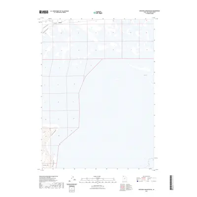
2023 Map of Crocodile Mountain NE
USGS Topo · Published 2023About this map
Kelton sits at the northern edge of this landscape, a place defined by its historical transportation corridors. Located within the Curlew Valley, the settlement is flanked by the Emigrant Trail Rd and the Old Railroad Grade Rd, reflecting the successive layers of westward migration and early steam-era infrastructure. The presence of the Kelton Cem serves as a tangible link to the families and individuals who once populated this corner of Box Elder County. To the south, the terrain rises toward Crocodile Mtn, while the eastern reaches of the map are dominated by the waters of Spring Bay. The modern Crocodile Mountain Rd provides access through this desert environment, where the proximity to the Great Salt Lake is evidenced by the low-lying marshlands and salt flats that surround the bay.
Find a feature on this map
8 named features on this map. Tap any name to fly to it.
Don’t see what you’re looking for? This feature index may not catch every label — zoom into the map to look around manually.
Map Details
Editions of this 2023 Crocodile Mountain NE Map
This is the sole edition of this map. No revisions or reprints were ever made.
Other maps of this area

1954 · Brigham City
USGS Topo · 1:250,000

1958 · Brigham City
USGS Topo · 1:250,000

1959 · Kelton Pass
USGS Topo · 1:62,500

1962 · Brigham City
USGS Topo · 1:250,000

1968 · Monument Peak SW
USGS Topo · 1:24,000

1969 · Peplin Flats
USGS Topo · 1:24,000

1969 · Spring Bay SW
USGS Topo · 1:24,000

1969 · Locomotive Springs
USGS Topo · 1:24,000

1969 · Crocodile Mtn NE
USGS Topo · 1:24,000

1969 · Hogup Bar
USGS Topo · 1:24,000