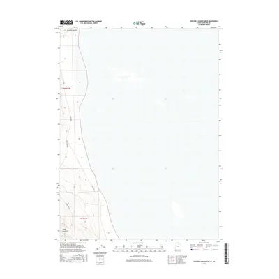
2017 Map of Crocodile Mountain SE
USGS Topo · Published 2017About this map
Crocodile Mountain and the Hogup Mountains dominate the western edge of this map, rising from the expansive flats of Box Elder County. This 2017 survey shows a landscape defined by its openness and minimal human footprint, with transportation limited to corridors like E Hogup Rd and Upper E Hogup Rd. The terrain transition is sharp, moving from the high ground of the mountains into broad, low-lying areas that suggest an arid environment. The map captures the township and range divisions, including t10n r11w and t9n r11w, illustrating the geometric land management system used across the American West. It is a portrait of a place where topography and rudimentary road networks remain the primary markers of location.
Find a feature on this map
6 named features on this map. Tap any name to fly to it.
Don’t see what you’re looking for? This feature index may not catch every label — zoom into the map to look around manually.
Map Details
Editions of this 2017 Crocodile Mountain SE Map
This is the sole edition of this map. No revisions or reprints were ever made.
Other maps of this area

1954 · Brigham City
USGS Topo · 1:250,000

1958 · Brigham City
USGS Topo · 1:250,000

1962 · Brigham City
USGS Topo · 1:250,000

1969 · Peplin Flats
USGS Topo · 1:24,000

1969 · Spring Bay SW
USGS Topo · 1:24,000

1969 · Dolphin Island West
USGS Topo · 1:24,000

1969 · Locomotive Springs
USGS Topo · 1:24,000
1969 · Dolphin Island East
USGS Topo · 1:24,000

1969 · Crocodile Mtn NE
USGS Topo · 1:24,000

1969 · Hogup Bar
USGS Topo · 1:24,000