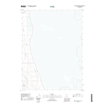
2020 Map of Crocodile Mountain SE
USGS Topo · Published 2020About this map
Hogup Mountain rises in the southwestern portion of this 2020 survey, anchoring a stark landscape in the remote Great Salt Lake Desert. The map reveals a minimal network of unpaved access routes including Upper East Hogup Rd and E Hogup Rd, tracing the base of the highlands where the rugged topography meets the vast, level expanse of the surrounding flats. These road placements suggest a reliance on peripheral travel around the mountain's edge, likely for range management or geological access in this sparsely populated region of Box Elder County. The eastern two-thirds of the quadrangle depict an incredibly open, featureless terrain, illustrating the extreme isolation characteristic of Utah's salt flat environments.
Find a feature on this map
4 named features on this map. Tap any name to fly to it.
Don’t see what you’re looking for? This feature index may not catch every label — zoom into the map to look around manually.
Map Details
Editions of this 2020 Crocodile Mountain SE Map
This is the sole edition of this map. No revisions or reprints were ever made.
Other maps of this area

1954 · Brigham City
USGS Topo · 1:250,000

1958 · Brigham City
USGS Topo · 1:250,000

1962 · Brigham City
USGS Topo · 1:250,000

1969 · Peplin Flats
USGS Topo · 1:24,000

1969 · Spring Bay SW
USGS Topo · 1:24,000

1969 · Dolphin Island West
USGS Topo · 1:24,000

1969 · Locomotive Springs
USGS Topo · 1:24,000
1969 · Dolphin Island East
USGS Topo · 1:24,000

1969 · Crocodile Mtn NE
USGS Topo · 1:24,000

1969 · Hogup Bar
USGS Topo · 1:24,000