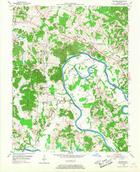
1954 Map of Cromwell
USGS Topo · Published 1967About this map
The Green River carves a deep, meandering path through the heart of this landscape, defining the boundary between Ohio Co and Butler Co. In the mid-1950s, this region was characterized by a river-and-rail economy, where the Illinois Central railroad lines served active strip mines in the western hills near Prentiss. The map captures a network of small, rural communities and family landmarks, including Logansport, Shultztown, and Highview. Notable for genealogists are the numerous country churches and associated burial grounds, such as New Harmony Ch, Slaty Creek Cem, and Lebanon Ch. Transportation across the river remained localized, evidenced by Reeds Ferry at Little Bend, while topographic features like Negro Hill and Tilford Knob dominate the interior terrain between the river's winding loops.
Find a feature on this map
43 named features on this map. Tap any name to fly to it.
Don’t see what you’re looking for? This feature index may not catch every label — zoom into the map to look around manually.
Map Details
Editions of this 1954 Cromwell Map
2 editions found
Other maps of this area

1909 · Hartford
USGS Topo · 1:62,500

1911 · Dunmor
USGS Topo · 1:48,000

1914 · Little Muddy
USGS Topo · 1:62,500

1914 · Dunmor
USGS Topo · 1:62,500

1925 · Spring Lick
USGS Topo · 1:62,500

1953 · South Hill
USGS Topo · 1:24,000

1953 · Rochester
USGS Topo · 1:24,000

1954 · Evansville
USGS Topo · 1:250,000

1954 · Horton
USGS Topo · 1:24,000
1954 · Paradise
USGS Topo · 1:24,000