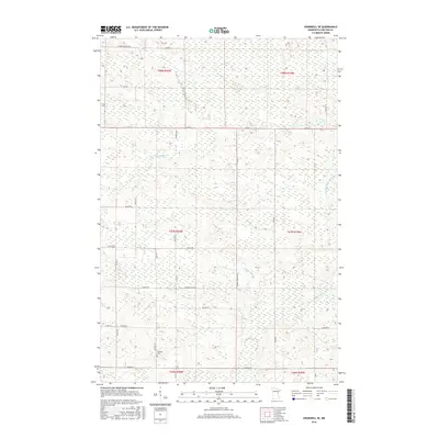
2016 Map of Cromwell SE
USGS Topo · Published 2016About this map
Kettle River meanders through the northwestern portion of this Carlton County landscape, carving a path through terrain dominated by wetlands and complex water systems. This 2016 survey illustrates a rural environment shaped by drainage patterns of the W Fork Moose Horn River and Gillespie Brook, where the land is partitioned into a dense network of township and county roads. Many of these thoroughfares, such as Heikkila Rd, Nasi Rd, Reuben Johnson Rd, and Antila Rd, carry family names that reflect the heritage of the local farming and timbering communities. The presence of Leonard Cem in the southwestern quadrant provides a specific point of interest for genealogists tracing family histories in this part of northern Minnesota, while the absence of major urban centers highlights the area's continued reliance on its natural waterways and regional road connectivity.
Find a feature on this map
33 named features on this map. Tap any name to fly to it.
Don’t see what you’re looking for? This feature index may not catch every label — zoom into the map to look around manually.
Map Details
Editions of this 2016 Cromwell SE Map
This is the sole edition of this map. No revisions or reprints were ever made.
Other maps of this area

1953 · Duluth
USGS Topo · 1:250,000

1954 · Sawyer
USGS Topo · 1:24,000

1956 · Barnum
USGS Topo · 1:62,500

1958 · Duluth
USGS Topo · 1:250,000

1961 · Cromwell
USGS Topo · 1:62,500

1961 · Moose Lake
USGS Topo · 1:62,500

1962 · Bruno
USGS Topo · 1:62,500

1980 · Sandstone
USGS Topo · 1:100,000

1980 · Duluth
USGS Topo · 1:100,000

1981 · Kettle River
USGS Topo · 1:24,000
Featured Places
- Skelton Township, MN
- Kalevala Township, MN
- Moose Lake Township, MN
- Barnum Township, MN
- North Carlton, MN