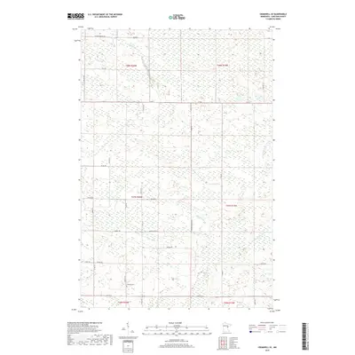
2019 Map of Cromwell SE
USGS Topo · Published 2019About this map
The Kettle River meanders through this landscape in Carlton County, defining a region characterized by its intricate water systems and rural road networks. Flowing through the townships of T47N and T48N, the river is joined by smaller tributaries like Gillespie Brook and the W Fork Moose Horn River. This 2019 survey documents a sparsely populated area where local infrastructure follows family and geographic naming traditions. Notable local landmarks include the Leonard Cem and a dense grid of township roads such as Heikkila Rd, Reuben Johnson Rd, and Antila Rd. The map illustrates the persistent 19th-century Public Land Survey System boundaries that continue to shape the modern parceling and transit routes of northern Minnesota, from Co Hwy 6 in the south to the northern reaches of E Four Corners Rd.
Find a feature on this map
35 named features on this map. Tap any name to fly to it.
Don’t see what you’re looking for? This feature index may not catch every label — zoom into the map to look around manually.
Map Details
Editions of this 2019 Cromwell SE Map
This is the sole edition of this map. No revisions or reprints were ever made.
Other maps of this area

1953 · Duluth
USGS Topo · 1:250,000

1954 · Sawyer
USGS Topo · 1:24,000

1956 · Barnum
USGS Topo · 1:62,500

1958 · Duluth
USGS Topo · 1:250,000

1961 · Cromwell
USGS Topo · 1:62,500

1961 · Moose Lake
USGS Topo · 1:62,500

1962 · Bruno
USGS Topo · 1:62,500

1980 · Sandstone
USGS Topo · 1:100,000

1980 · Duluth
USGS Topo · 1:100,000

1981 · Kettle River
USGS Topo · 1:24,000
Featured Places
- Skelton Township, MN
- Kalevala Township, MN
- Moose Lake Township, MN
- Barnum Township, MN
- North Carlton, MN