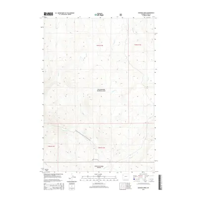
2015 Map of Crooked Creek
USGS Topo · Published 2015About this map
Yellowstone National Park and the Teton National Forest meet in this high-altitude wilderness survey, where the Continental Divide National Scenic Trail winds through the southern reaches of the park. The landscape is defined by the headwaters of several major drainages, most notably the Snake River, which flows through the southwestern corner near Big Game Ridge. The map illustrates a complex network of alpine hydrology, including Crooked Cr, Chipmunk Cr, and Passage Cr, all of which feed the larger river systems of the Greater Yellowstone Ecosystem.
Find a feature on this map
16 named features on this map. Tap any name to fly to it.
Don’t see what you’re looking for? This feature index may not catch every label — zoom into the map to look around manually.
Map Details
Editions of this 2015 Crooked Creek Map
This is the sole edition of this map. No revisions or reprints were ever made.
Other maps of this area

1885 · Lake
USGS Topo · 1:125,000

1895 · Lake
USGS Topo · 1:125,000

1896 · Lake
USGS Topo · 1:125,000

1901 · Lake
USGS Topo · 1:125,000

1906 · Lake
USGS Topo · 1:125,000

1911 · Lake
USGS Topo · 1:125,000

1955 · Ashton
USGS Topo · 1:250,000

1958 · Ashton
USGS Topo · 1:250,000
1959 · Mount Hancock
USGS Topo · 1:62,500
1959 · Two Ocean Pass
USGS Topo · 1:62,500