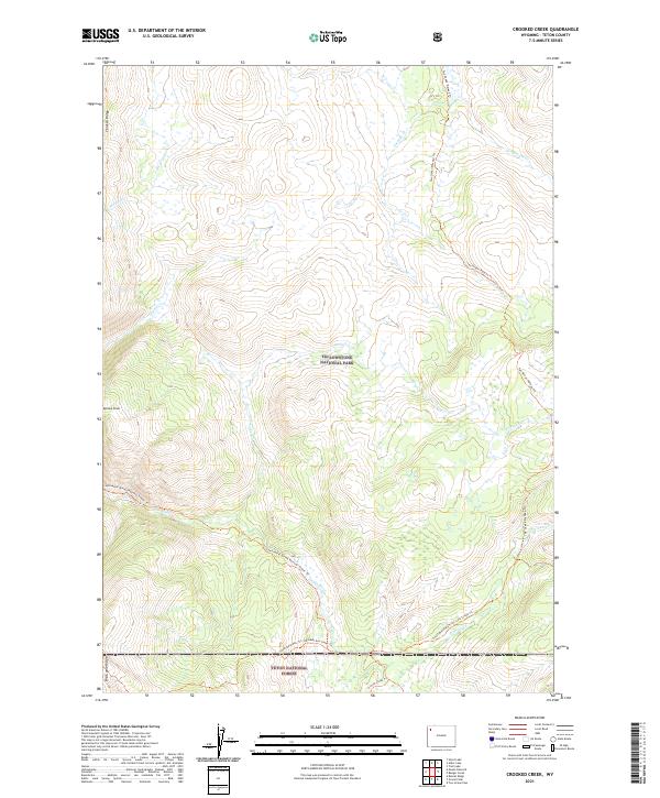
2021 Map of Crooked Creek
USGS Topo · Published 2021About this map
Yellowstone National Park and the Teton National Forest meet in this high-altitude landscape defined by the upper reaches of the Snake River. The protected status of the Snake River Headwaters Wild and Scenic River preserves a complex network of tributaries, including Crooked Cr, Passage Cr, and Chipmunk Cr. Without any permanent settlements or roads, the geography is articulated through long-distance paths such as the Continental Divide National Scenic Trl and the Two Ocean Plateau Trl. High ridges like Chicken Ridge and Big Game Ridge separate the various drainage basins. This map illustrates the intersection of federal land management and major natural watersheds near Barlow Peak, where the topography dictates travel routes through the South Boundary Trail system.
Find a feature on this map
22 named features on this map. Tap any name to fly to it.
Don’t see what you’re looking for? This feature index may not catch every label — zoom into the map to look around manually.
Map Details
Editions of this 2021 Crooked Creek Map
This is the sole edition of this map. No revisions or reprints were ever made.
Other maps of this area

1885 · Lake
USGS Topo · 1:125,000

1895 · Lake
USGS Topo · 1:125,000

1896 · Lake
USGS Topo · 1:125,000

1901 · Lake
USGS Topo · 1:125,000

1906 · Lake
USGS Topo · 1:125,000

1911 · Lake
USGS Topo · 1:125,000

1955 · Ashton
USGS Topo · 1:250,000

1958 · Ashton
USGS Topo · 1:250,000
1959 · Mount Hancock
USGS Topo · 1:62,500
1959 · Two Ocean Pass
USGS Topo · 1:62,500