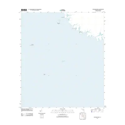
2012 Map of Crooked Point
USGS Topo · Published 2012About this map
The coastal margins of the Gulf Of Mexico define this section of Taylor County, where tidal creeks and salt marshes create a complex shoreline profile. Significant landmarks such as Crooked Point and Long Grass Point extend into the shallow waters, marking a transition between the terrestrial wetlands and the open gulf. Navigational and scientific interests are represented by offshore installations, including the University of Florida Lighted Data Tower and Big Bend Light 18, which serve as vital reference points in a region dominated by maritime movement.
Find a feature on this map
12 named features on this map. Tap any name to fly to it.
Don’t see what you’re looking for? This feature index may not catch every label — zoom into the map to look around manually.
Map Details
Editions of this 2012 Crooked Point Map
This is the sole edition of this map. No revisions or reprints were ever made.
Other maps of this area

1954 · Steinhatchee SW
USGS Topo · 1:24,000

1954 · Salem SW
USGS Topo · 1:24,000

1954 · Steinhatchee
USGS Topo · 1:24,000

1954 · Keaton Beach
USGS Topo · 1:24,000

1954 · Crooked Point
USGS Topo · 1:24,000

1954 · Gainesville
USGS Topo · 1:250,000

1958 · Gainesville
USGS Topo · 1:250,000

1959 · Gainesville
USGS Topo · 1:250,000
1978 · Cross City
USGS Topo · 1:100,000
2012 · Salem SW
USGS Topo · 1:24,000