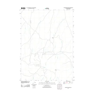
2012 Map of Crooks Mountain
USGS Topo · Published 2012About this map
The Happy Springs Oil Field serves as a primary industrial landmark in this corner of Fremont County, where extraction infrastructure meets the drainage basins of the high plains. The landscape is defined by a network of seasonal watercourses and drainages, most notably Cottonwood Cr and Nancy Cr, which flow through the draws surrounding Crooks Mountain. These waterways are supported by small catchments such as Boggy Springs Pond and Woods Gulch Pond, vital for land management in this arid environment. Transportation through this part of the Wyoming interior is largely limited to unpaved routes like Happy Springs Rd, reflecting a region dominated by resource management and ranching. The convergence of W Arapahoe Cr and E Arapahoe Cr in the southern portion further illustrates the intricate local hydrography of the Woods Gulch vicinity.
Find a feature on this map
14 named features on this map. Tap any name to fly to it.
Don’t see what you’re looking for? This feature index may not catch every label — zoom into the map to look around manually.
Map Details
Editions of this 2012 Crooks Mountain Map
This is the sole edition of this map. No revisions or reprints were ever made.
Other maps of this area

1951 · Soap Holes
USGS Topo · 1:24,000

1951 · Crooks Creek NE
USGS Topo · 1:24,000

1951 · Stampede Meadow
USGS Topo · 1:24,000

1951 · Graham Ranch
USGS Topo · 1:24,000

1951 · Crooks Mountain
USGS Topo · 1:24,000

1951 · Myers Ranch
USGS Topo · 1:24,000

1955 · Lander
USGS Topo · 1:250,000

1955 · Casper
USGS Topo · 1:250,000

1957 · Jeffrey City
USGS Topo · 1:24,000

1958 · Casper
USGS Topo · 1:250,000