
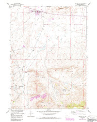
1957 Map of Jeffrey City
USGS Topo · Published 1958About this map
Jeffrey City (Home on the Range PO) emerges as a burgeoning hub for the uranium mining industry in this mid-1950s survey. The landscape reflects a sudden industrial transition, featuring a Landing Strip and numerous Gravel Pits alongside the traditional livestock operations of the John Kirk Ranch. The survey captures the energy infrastructure of the central Wyoming basins, documenting the development of the Crooks Gap Oil Field and the Sheep Creek Oil Field north of the Green Mountains.
Find a feature on this map
27 named features on this map. Tap any name to fly to it.
Don’t see what you’re looking for? This feature index may not catch every label — zoom into the map to look around manually.
Map Details
Editions of this 1957 Jeffrey City Map
2 editions found
Other maps of this area

1951 · Crooks Creek NE
USGS Topo · 1:24,000

1951 · Stampede Meadow
USGS Topo · 1:24,000

1951 · Black Rock Gap
USGS Topo · 1:24,000

1951 · Graham Ranch
USGS Topo · 1:24,000

1951 · Split Rock NW
USGS Topo · 1:24,000

1951 · Crooks Mountain
USGS Topo · 1:24,000

1955 · Casper
USGS Topo · 1:250,000

1958 · Casper
USGS Topo · 1:250,000

1961 · Crooks Peak
USGS Topo · 1:24,000
1961 · Brenton Springs
USGS Topo · 1:24,000