
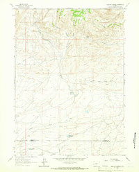
1951 Map of Crooks Creek NE
USGS Topo · Published 1953About this map
The Green Mountains and Sheep Mountain dominate the southern half of this 1951 topographic survey, marking a rugged transition in the Wyoming landscape. This era in Fremont County was defined by energy extraction, evidenced by the clustered infrastructure of the Crooks Gap Oil Field and the Sheep Creek Oil Field. These industrial zones are marked by Oil Wells, localized Oil Tanks, and a dedicated Landing Strip, signifying the technological footprint of the postwar oil boom in relatively isolated territory.
Find a feature on this map
21 named features on this map. Tap any name to fly to it.
Don’t see what you’re looking for? This feature index may not catch every label — zoom into the map to look around manually.
Map Details
Editions of this 1951 Crooks Creek NE Map
This is the sole edition of this map. No revisions or reprints were ever made.
Other maps of this area

1951 · Stampede Meadow
USGS Topo · 1:24,000

1951 · Black Rock Gap
USGS Topo · 1:24,000

1951 · Graham Ranch
USGS Topo · 1:24,000

1951 · Split Rock NW
USGS Topo · 1:24,000

1951 · Crooks Mountain
USGS Topo · 1:24,000

1955 · Casper
USGS Topo · 1:250,000

1957 · Jeffrey City
USGS Topo · 1:24,000

1958 · Casper
USGS Topo · 1:250,000

1961 · Crooks Peak
USGS Topo · 1:24,000
1961 · Brenton Springs
USGS Topo · 1:24,000