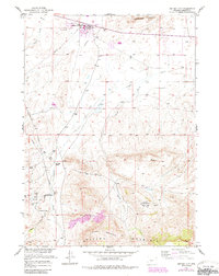
1957 Map of Jeffrey City
USGS Topo · Published 1985About this map
Jeffrey City, formerly known as the Home on the Range PO, sits at the northern edge of a landscape defined by ranching and energy extraction. This 1957 survey, with revisions into the mid-1980s, captures the local infrastructure of the John Kirk Ranch and a network of pipelines that support the region's industrial base. The map details the significant presence of the Crooks Gap Oil Field and Sheep Creek Oil Field, where numerous oil wells and tanks are clustered near the base of the mountains.
Find a feature on this map
22 named features on this map. Tap any name to fly to it.
Don’t see what you’re looking for? This feature index may not catch every label — zoom into the map to look around manually.
Map Details
Editions of this 1957 Jeffrey City Map
2 editions found
Other maps of this area

1951 · Crooks Creek NE
USGS Topo · 1:24,000

1951 · Stampede Meadow
USGS Topo · 1:24,000

1951 · Black Rock Gap
USGS Topo · 1:24,000

1951 · Graham Ranch
USGS Topo · 1:24,000

1951 · Split Rock NW
USGS Topo · 1:24,000

1951 · Crooks Mountain
USGS Topo · 1:24,000

1955 · Casper
USGS Topo · 1:250,000

1957 · Jeffrey City
USGS Topo · 1:24,000

1958 · Casper
USGS Topo · 1:250,000

1961 · Crooks Peak
USGS Topo · 1:24,000