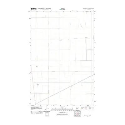
2010 Map of Crookston NE
USGS Topo · Published 2010About this map
The agricultural landscape of Polk County is defined by a precise section-line grid of rural roads and scattered aviation facilities. This 2010 survey illustrates the transition of the Red River Valley prairie into a highly organized farming region, where specialized infrastructure like Kaml Airstrip and Gasper Airport serve the local community. The presence of School Number 29 reflects the historical distribution of rural education centers, typically situated at the intersections of county routes such as County Hwy-19 and County Hwy-54. This area northeast of the regional center maintains its early 21st-century character through a network of arterial highways including County Hwy-52 and County Hwy-17, supporting the logistical needs of a vast, productive terrain.
Find a feature on this map
9 named features on this map. Tap any name to fly to it.
Don’t see what you’re looking for? This feature index may not catch every label — zoom into the map to look around manually.
Map Details
Editions of this 2010 Crookston NE Map
This is the sole edition of this map. No revisions or reprints were ever made.
Other maps of this area

1918 · Angus
USGS Topo · 1:62,500

1918 · Red Lake Falls
USGS Topo · 1:62,500

1918 · Viking
USGS Topo · 1:62,500

1952 · Red Lake Falls
USGS Topo · 1:62,500

1952 · Grand Forks
USGS Topo · 1:250,000

1952 · Thief River Falls
USGS Topo · 1:250,000

1953 · Crookston
USGS Topo · 1:62,500

1956 · Thief River Falls
USGS Topo · 1:250,000

1956 · Grand Forks
USGS Topo · 1:250,000

1957 · Thief River Falls
USGS Topo · 1:250,000