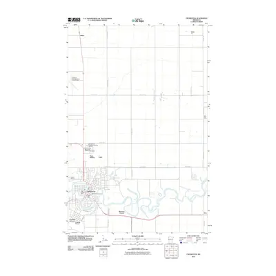
2010 Map of Crookston
USGS Topo · Published 2010About this map
The Red Lake River snakes through the heart of the Red River Valley, defining the geography of Crookston and its surrounding agricultural landscape. This 2010 survey shows a community anchored by institutional and transit hubs, including the University of Minnesota Technical Institute and the University of Minnesota Experimental Station. The town's layout is framed by residential extensions like Riverview Terrace and Carman Terrace, while the local economy and logistics are served by the Crookston Municipal Airport-Kirkwood Field and the Crookston Post Office. Beyond the city center, the map reveals a traditional prairie schoolhouse pattern, with sites like Brick School, Valley View School, and School Number 173 spaced across the rural sections. These small settlements, such as Shirley, Anglim, and Noyes Junction, provide critical points of reference for genealogists tracing family land and rural development in Polk County during the early 21st century.
Find a feature on this map
30 named features on this map. Tap any name to fly to it.
Don’t see what you’re looking for? This feature index may not catch every label — zoom into the map to look around manually.
Map Details
Editions of this 2010 Crookston Map
This is the sole edition of this map. No revisions or reprints were ever made.
Other maps of this area

1918 · Red Lake Falls
USGS Topo · 1:62,500

1919 · Beltrami
USGS Topo · 1:62,500

1952 · Red Lake Falls
USGS Topo · 1:62,500

1952 · Grand Forks
USGS Topo · 1:250,000

1953 · Crookston
USGS Topo · 1:62,500

1956 · Grand Forks
USGS Topo · 1:250,000

1964 · Girard
USGS Topo · 1:24,000

1964 · Greenview
USGS Topo · 1:24,000

1965 · Harold
USGS Topo · 1:24,000

1966 · Grand Forks
USGS Topo · 1:250,000