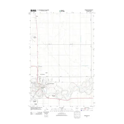
2013 Map of Crookston
USGS Topo · Published 2013About this map
Red Lake River snakes through the heart of Crookston, defining the landscape of this northwestern Minnesota community. This modern survey illustrates the town's northward expansion toward the Univ Of Minnesota-Crookston campus and the industrial and transportation nodes at Noyes Junction and Shirley. The river's complex oxbows create distinct neighborhoods like Forest Knolls Estates and Riverview Terrace, while also shaping recreational spaces such as the Central Park Campground and natural features like Aunt Pollys Slough. To the south, the rail history is preserved in names like Crookston Junction and Carman Terrace, while the Crookston Municipal Airport-Kirkwood Field anchors the northwestern edge of the map. Genealogists will find the Oakdale Cem clearly marked on the western outskirts of the city.
Find a feature on this map
40 named features on this map. Tap any name to fly to it.
Don’t see what you’re looking for? This feature index may not catch every label — zoom into the map to look around manually.
Map Details
Editions of this 2013 Crookston Map
This is the sole edition of this map. No revisions or reprints were ever made.
Other maps of this area

1918 · Red Lake Falls
USGS Topo · 1:62,500

1919 · Beltrami
USGS Topo · 1:62,500

1952 · Red Lake Falls
USGS Topo · 1:62,500

1952 · Grand Forks
USGS Topo · 1:250,000

1953 · Crookston
USGS Topo · 1:62,500

1956 · Grand Forks
USGS Topo · 1:250,000

1964 · Girard
USGS Topo · 1:24,000

1964 · Greenview
USGS Topo · 1:24,000

1965 · Harold
USGS Topo · 1:24,000

1966 · Grand Forks
USGS Topo · 1:250,000