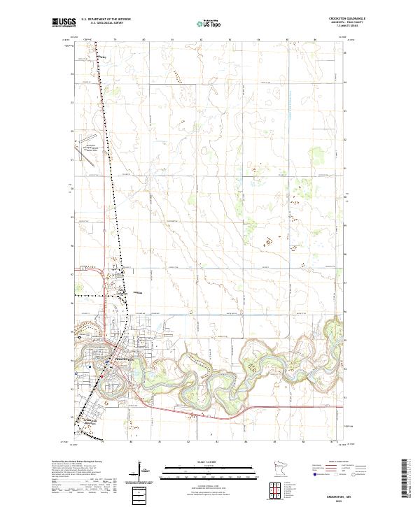
2022 Map of Crookston
USGS Topo · Published 2022About this map
The Red Lake River creates a meandering central corridor through this Polk County landscape, defining the layout of Crookston. The city’s residential and institutional footprint is visible in the detailed street grids south of the University of Minnesota Crookston campus. Significant for genealogists and local historians, the map identifies various outlying railway points and small settlements, including Shirley to the north and the nearby Noyes Junction and Anglim. The surrounding agricultural terrain is intersected by an extensive network of drainage systems, such as Judicial Ditch Number Sixty, which reflect the region's managed hydrology. On the western edge of the city, the Oakdale Cem and the Crookston Municipal Airport-Kirkwood Field serve as prominent local landmarks, while water features like Aunt Pollys Slough highlight the natural riverine environment.
Find a feature on this map
82 named features on this map. Tap any name to fly to it.
Don’t see what you’re looking for? This feature index may not catch every label — zoom into the map to look around manually.
Map Details
Editions of this 2022 Crookston Map
This is the sole edition of this map. No revisions or reprints were ever made.
Other maps of this area

1918 · Red Lake Falls
USGS Topo · 1:62,500

1919 · Beltrami
USGS Topo · 1:62,500

1952 · Red Lake Falls
USGS Topo · 1:62,500

1952 · Grand Forks
USGS Topo · 1:250,000

1953 · Crookston
USGS Topo · 1:62,500

1956 · Grand Forks
USGS Topo · 1:250,000

1964 · Girard
USGS Topo · 1:24,000

1964 · Greenview
USGS Topo · 1:24,000

1965 · Harold
USGS Topo · 1:24,000

1966 · Grand Forks
USGS Topo · 1:250,000