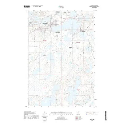
2019 Map of Crosby
USGS Topo · Published 2019About this map
Armour Number Two Mine stands as a prominent reminder of the region's industrial foundations, located between the growing communities of Crosby and Ironton. This survey illustrates a landscape deeply shaped by mining and water, where the massive waters of Serpent Lake and Clearwater Lake dominate the geography alongside smaller settlements like Cuyuna and Deerwood. The map captures a complex network of haul roads and access routes, including Cruft Mine Rd and New Haul Road, which underscore the ongoing commercial activity in this portion of Crow Wing County.
Find a feature on this map
143 named features on this map. Tap any name to fly to it.
Don’t see what you’re looking for? This feature index may not catch every label — zoom into the map to look around manually.
Map Details
Editions of this 2019 Crosby Map
This is the sole edition of this map. No revisions or reprints were ever made.
Other maps of this area

1912 · Deerwood
USGS Topo · 1:62,500

1913 · Cuyuna
USGS Topo · 1:62,500

1914 · Deerwood
USGS Topo · 1:62,500

1915 · Cuyuna
USGS Topo · 1:62,500

1915 · Brainerd
USGS Topo · 1:62,500

1918 · Brainerd
USGS Topo · 1:62,500

1953 · Duluth
USGS Topo · 1:250,000

1953 · Brainerd
USGS Topo · 1:250,000

1957 · Brainerd
USGS Topo · 1:250,000

1958 · Brainerd
USGS Topo · 1:250,000