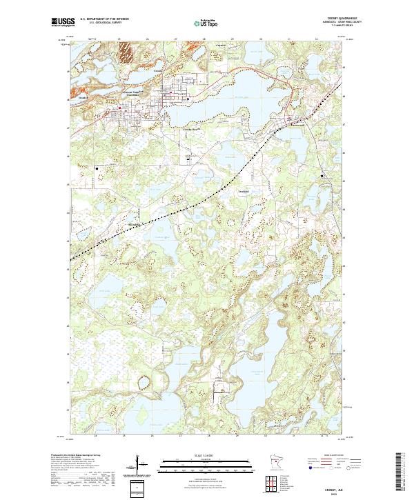
2022 Map of Crosby
USGS Topo · Published 2022About this map
The Armour Number Two Mine stands as a significant industrial landmark on the north side of this landscape, evidence of the iron mining legacy that shaped the Cuyuna Range. Nearby, the connected communities of Crosby and Ironton are densely mapped, showing a transition toward recreation with the Cuyuna Lakes State Trl and Crosby Beach on Serpent Lake. The southern half of the map shifts to a dense labyrinth of water and wetlands, where the Nokasippi River flows through a series of named bodies including Eagle Lake, Clearwater Lake, and Nokay Lake. Smaller settlements and localities like Klondyke, Oreland, and Indian Point dot the woods, while several burial grounds including Lakewood Cem and Deerwood Cem provide essential points of reference for genealogists tracking families from the mining and timber eras.
Find a feature on this map
64 named features on this map. Tap any name to fly to it.
Don’t see what you’re looking for? This feature index may not catch every label — zoom into the map to look around manually.
Map Details
Editions of this 2022 Crosby Map
This is the sole edition of this map. No revisions or reprints were ever made.
Other maps of this area

1912 · Deerwood
USGS Topo · 1:62,500

1913 · Cuyuna
USGS Topo · 1:62,500

1914 · Deerwood
USGS Topo · 1:62,500

1915 · Cuyuna
USGS Topo · 1:62,500

1915 · Brainerd
USGS Topo · 1:62,500

1918 · Brainerd
USGS Topo · 1:62,500

1953 · Duluth
USGS Topo · 1:250,000

1953 · Brainerd
USGS Topo · 1:250,000

1957 · Brainerd
USGS Topo · 1:250,000

1958 · Brainerd
USGS Topo · 1:250,000