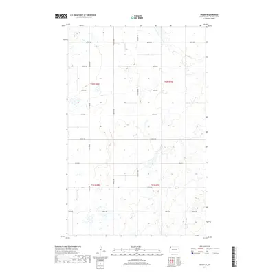
2017 Map of Crosby SE
USGS Topo · Published 2017About this map
Glacial depressions and prairie potholes define the landscape of this Divide County region, where the section-line road grid organizes a sparsely populated agricultural expanse. Surveyed for the U.S. Geological Survey in the mid-2010s, the terrain is partitioned by township boundaries including t162n r98w, t162n r97w, t161n r98w, and t161n r97w. The transportation network is built upon a rigid system of gravel and dirt routes such as 119th Ave NW and 100th St NW, reflecting the late-era Rural Addressing System used to manage this remote corner of North Dakota. The primary corridor for local transit is Co 14, which cuts horizontally across the southern half of the quadrangle. For researchers, this map clarifies the contemporary land use and hydraulic patterns of the northern Great Plains, illustrating how modern road designations have overlaid the original public land survey system.
Find a feature on this map
18 named features on this map. Tap any name to fly to it.
Don’t see what you’re looking for? This feature index may not catch every label — zoom into the map to look around manually.
Map Details
Editions of this 2017 Crosby SE Map
This is the sole edition of this map. No revisions or reprints were ever made.
Other maps of this area

1948 · Alamo N.E.
USGS Topo · 1:24,000

1948 · Crosby SW
USGS Topo · 1:24,000

1948 · Ambrose
USGS Topo · 1:24,000

1948 · Bright Water Lake
USGS Topo · 1:24,000

1948 · Crosby
USGS Topo · 1:24,000

1948 · Crosby SE
USGS Topo · 1:24,000

1949 · Paulson
USGS Topo · 1:24,000

1949 · Noonan SW
USGS Topo · 1:24,000

1950 · Crosby
USGS Topo · 1:62,500

1950 · Noonan
USGS Topo · 1:62,500