
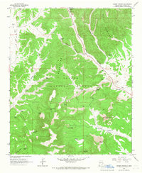
1964 Map of Crosby Springs
USGS Topo · Published 1967About this map
The Cibola National Forest encompasses this high-altitude landscape in Catron County, where the Datil Mountains meet the Crosby Mountains. In the early 1960s, this area was defined by its water sources and isolated structures rather than established towns. Small ranching or forest outposts like Baldwin Cabin and the site at Pine Park provided rare points of human habitation amidst the canyons.
Find a feature on this map
39 named features on this map. Tap any name to fly to it.
Don’t see what you’re looking for? This feature index may not catch every label — zoom into the map to look around manually.
Map Details
Editions of this 1964 Crosby Springs Map
2 editions found
Other maps of this area

1954 · Saint Johns
USGS Topo · 1:250,000

1954 · Socorro
USGS Topo · 1:250,000

1957 · Saint Johns
USGS Topo · 1:250,000

1958 · Socorro
USGS Topo · 1:250,000

1958 · Saint Johns
USGS Topo · 1:250,000

1962 · Socorro
USGS Topo · 1:250,000

1962 · Saint Johns
USGS Topo · 1:250,000

1963 · Cal Ship Mesa
USGS Topo · 1:24,000

1963 · Anderson Peak
USGS Topo · 1:24,000

1963 · Datil
USGS Topo · 1:24,000