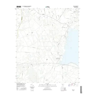
2017 Map of Cross
USGS Topo · Published 2017About this map
Lake Moultrie defines the eastern shoreline of this Berkeley County landscape, where the low-lying terrain is dominated by a dense network of Carolina bays and named wetlands. Local history is anchored by settlements like Cross and Moorefield, along with a series of community burial grounds including Zion Cem, Friendship Cem, and Grooms Cem. The geography is characterized by an extensive system of depressions such as Buzzard Bay, Negro Bay, and Pigeon Bay, which sit alongside more elevated features like Layton Ridge. The southern portion of the map transitions into the deep waters of Wassamassaw Swamp and Big Run. For researchers, the presence of Lesesne Airport and a grid of rural lanes like Spiers Landing Rd provide insight into the modern infrastructure layered over this traditional Lowcountry environment.
Find a feature on this map
79 named features on this map. Tap any name to fly to it.
Don’t see what you’re looking for? This feature index may not catch every label — zoom into the map to look around manually.
Map Details
Editions of this 2017 Cross Map
This is the sole edition of this map. No revisions or reprints were ever made.
Other maps of this area

1919 · Summerville
USGS Topo · 1:48,000

1919 · Ridgeville
USGS Topo · 1:48,000

1920 · Eutawville
USGS Topo · 1:48,000

1920 · Chicora
USGS Topo · 1:48,000

1920 · Ridgeville
USGS Topo · 1:62,500

1920 · Summerville
USGS Topo · 1:62,500

1921 · Chicora
USGS Topo · 1:62,500

1921 · Eutawville
USGS Topo · 1:62,500

1943 · Chicora
USGS Topo · 1:62,500

1943 · Ridgeville
USGS Topo · 1:62,500