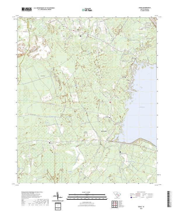
2024 Map of Cross
USGS Topo · Published 2024About this map
Lake Moultrie defines the eastern shoreline of this Berkeley County landscape, where the coastal plain transitions into a complex network of bays and wetlands. The settlement of Cross serves as a local hub near the lake's edge, supported by smaller communities such as Moorefield, Prioleau, and Nelson Hill. This area is notably characterized by a high density of "bays"—distinctive elliptical depressions in the terrain—including Powell Bay, Pigeon Bay, and Beech Island Bay. For those researching local lineages, the map preserves the locations of the Friendship Church Graveyard and several family or community burial sites like Zion Cem, Grooms Cem, and Mount Olivet Cem. The hydrological pattern is shaped by Little Black Creek and the expansive Wassamassaw Swamp, illustrating the intricate water systems that have influenced land use and settlement patterns in this part of South Carolina.
Find a feature on this map
83 named features on this map. Tap any name to fly to it.
Don’t see what you’re looking for? This feature index may not catch every label — zoom into the map to look around manually.
Map Details
Editions of this 2024 Cross Map
This is the sole edition of this map. No revisions or reprints were ever made.
Other maps of this area

1919 · Summerville
USGS Topo · 1:48,000

1919 · Ridgeville
USGS Topo · 1:48,000

1920 · Eutawville
USGS Topo · 1:48,000

1920 · Chicora
USGS Topo · 1:48,000

1920 · Ridgeville
USGS Topo · 1:62,500

1920 · Summerville
USGS Topo · 1:62,500

1921 · Chicora
USGS Topo · 1:62,500

1921 · Eutawville
USGS Topo · 1:62,500

1943 · Chicora
USGS Topo · 1:62,500

1943 · Ridgeville
USGS Topo · 1:62,500