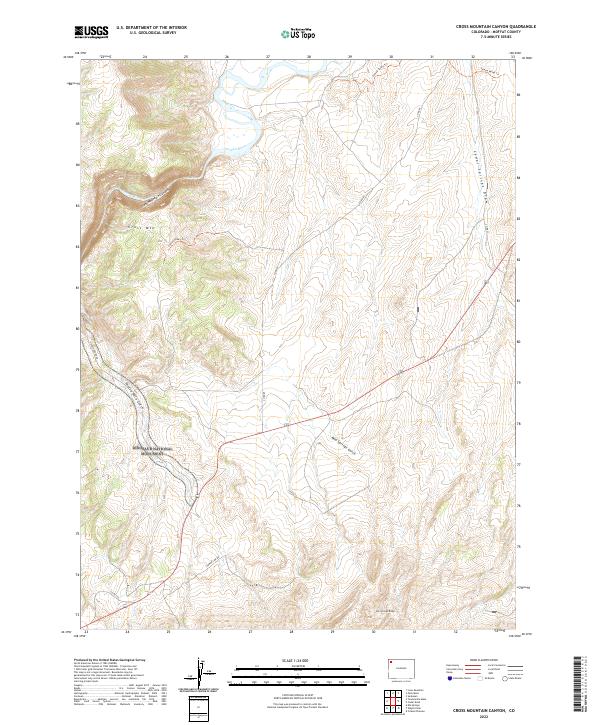
2022 Map of Cross Mountain Canyon
USGS Topo · Published 2022About this map
The Yampa River carves a dramatic path through the northwest corner of this Colorado map, where it flows through the depths of Cross Mountain Canyon. The landscape is dominated by the steep rises of Cross Mtn and the long descent of Twelve Mile Gulch, which trends toward the southwestern edge. Much of the western territory is protected within Dinosaur National Monument, showcasing a wilderness area characterized by high ridges like Elk Springs Ridge and dry drainage systems such as Cedar Springs Draw. Access is limited to remote corridors like Deerlodge Road and the Yampa Valley Trl, highlighting the isolation and topographical complexity of the Moffat County terrain. This survey illustrates the intricate drainage patterns of Mud Springs Gulch as they relate to the surrounding plateau structures.
Find a feature on this map
18 named features on this map. Tap any name to fly to it.
Don’t see what you’re looking for? This feature index may not catch every label — zoom into the map to look around manually.
Map Details
Editions of this 2022 Cross Mountain Canyon Map
This is the sole edition of this map. No revisions or reprints were ever made.
Other maps of this area

1907 · White River
USGS Topo · 1:125,000

1910 · White River
USGS Topo · 1:125,000

1954 · Vernal
USGS Topo · 1:250,000

1958 · Vernal
USGS Topo · 1:250,000

1958 · Maybell
USGS Topo · 1:62,500

1958 · Citadel Plateau
USGS Topo · 1:62,500

1960 · Vernal
USGS Topo · 1:250,000

1960 · Elk Springs
USGS Topo · 1:62,500

1960 · Lone Mountain
USGS Topo · 1:62,500
1979 · Rangely
USGS Topo · 1:100,000