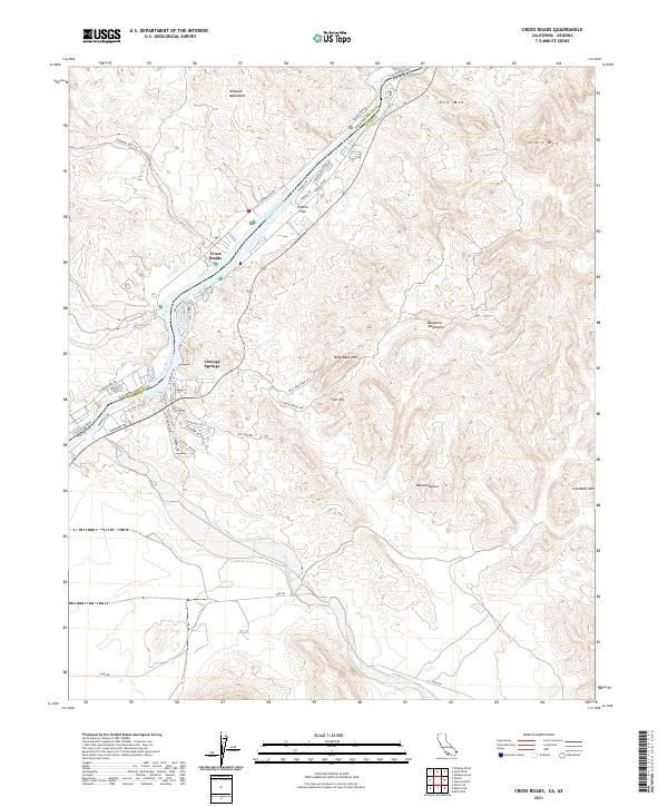
2021 Map of Cross Roads
USGS Topo · Published 2021About this map
The Colorado River carves a clear dividing line through this desert landscape, serving as the border between San Bernardino County, California, and La Paz County, Arizona. Riverside developments like Cienega Springs, Cross Roads, and Empire Flat cluster along the western bank, connected by the winding Parker Dam Rd and local residential routes such as Lakeside Blvd and Riverside Dr. This area represents a corridor of habitation and recreation nestled between the water and the rising terrain of the Whipple Mountains.
Find a feature on this map
42 named features on this map. Tap any name to fly to it.
Don’t see what you’re looking for? This feature index may not catch every label — zoom into the map to look around manually.
Map Details
Editions of this 2021 Cross Roads Map
This is the sole edition of this map. No revisions or reprints were ever made.
Other maps of this area

1911 · Parker
USGS Topo · 1:125,000

1943 · Giers Basin
USGS Topo · 1:62,500

1943 · Whipple Mts.
USGS Topo · 1:62,500

1943 · Parker
USGS Topo · 1:62,500

1949 · Parker
USGS Topo · 1:62,500

1950 · Parker Dam Area
USGS Topo · 1:62,500

1950 · Parker
USGS Topo · 1:62,500

1950 · Whipple Mts
USGS Topo · 1:62,500

1952 · Whipple Mts
USGS Topo · 1:62,500

1954 · Needles
USGS Topo · 1:250,000