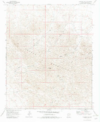
1970 Map of Crossman Peak
USGS Topo · Published 1983About this map
Crossman Peak dominates this arid landscape within the Mohave Mountains, serving as a focal point for a region defined by high-desert resource extraction. The 1970 field check reveals a network of industrial sites including the Pittsburg Mine and the Jupiter Mine, both situated near rugged terrain features like Jupiter Spring. The prevalence of water-related landmarks such as Blacksmith Canyon Well, Scotts Well, and Arrastra Well indicates the essential infrastructure required for survival and industry in this dry environment. Much of the movement through this area is facilitated by a network of Jeep Trails, which connect various prospects and springs. The map documents a landscape where the natural drainage patterns of Falls Springs Wash and numerous canyons like Blacksmith Canyon dictate the placement of local improvements and mining activity.
Find a feature on this map
17 named features on this map. Tap any name to fly to it.
Don’t see what you’re looking for? This feature index may not catch every label — zoom into the map to look around manually.
Map Details
Editions of this 1970 Crossman Peak Map
4 editions found
Other maps of this area

1903 · Needles
USGS Topo · 1:125,000

1904 · Needles Special
USGS Topo · 1:125,000

1911 · Parker
USGS Topo · 1:125,000

1927 · Buck Mountains
USGS Topo · 1:62,500

1929 · Buck Mountains
USGS Topo · 1:62,500

1943 · Giers Basin
USGS Topo · 1:62,500

1943 · Topock
USGS Topo · 1:62,500

1943 · Whipple Mts.
USGS Topo · 1:62,500

1950 · Topock
USGS Topo · 1:62,500

1950 · Whipple Mts
USGS Topo · 1:62,500