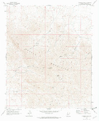
1970 Map of Crossman Peak
USGS Topo · Published 1973About this map
Crossman Peak stands as the central landmark of the Mohave Mountains in this 1970 survey, a landscape defined by its rugged verticality and history of mineral exploration. Remote mining operations are scattered across the terrain, including the Sunrise Mine and Jupiter Mine near the center of the range, and the Pittsburg Mine to the southwest. These sites, often accessed only by a network of Jeep Trails, reflect the region's enduring reliance on small-scale prospecting and extraction.
Find a feature on this map
21 named features on this map. Tap any name to fly to it.
Don’t see what you’re looking for? This feature index may not catch every label — zoom into the map to look around manually.
Map Details
Editions of this 1970 Crossman Peak Map
4 editions found
Other maps of this area

1903 · Needles
USGS Topo · 1:125,000

1904 · Needles Special
USGS Topo · 1:125,000

1911 · Parker
USGS Topo · 1:125,000

1927 · Buck Mountains
USGS Topo · 1:62,500

1929 · Buck Mountains
USGS Topo · 1:62,500

1943 · Giers Basin
USGS Topo · 1:62,500

1943 · Topock
USGS Topo · 1:62,500

1943 · Whipple Mts.
USGS Topo · 1:62,500

1950 · Topock
USGS Topo · 1:62,500

1950 · Whipple Mts
USGS Topo · 1:62,500