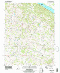
1993 Map of Crosstown
USGS Topo · Published 1996About this map
The Mississippi River forms a major geographic boundary in the northeast, marking the state line between Illinois and Missouri. The terrain is defined by a dense network of drainages, including Omete Creek and Brazeau Creek, which carve through the landscape toward the river valley. On the Missouri side, small rural communities such as Crosstown, Farrar, and Brazeau serve as local hubs, connected by winding country roads that follow the ridges and valleys.
Find a feature on this map
15 named features on this map. Tap any name to fly to it.
Don’t see what you’re looking for? This feature index may not catch every label — zoom into the map to look around manually.
Map Details
Editions of this 1993 Crosstown Map
This is the sole edition of this map. No revisions or reprints were ever made.
Other maps of this area

1915 · Chester
USGS Topo · 1:62,500

1916 · Campbell Hill
USGS Topo · 1:62,500

1918 · Altenburg
USGS Topo · 1:62,500

1918 · Campbell Hill
USGS Topo · 1:62,500

1923 · Perryville
USGS Topo · 1:62,500

1924 · Perryville
USGS Topo · 1:62,500

1925 · Altenburg
USGS Topo · 1:62,500

1947 · Chester
USGS Topo · 1:62,500

1947 · Crosstown
USGS Topo · 1:24,000

1947 · Oak Ridge
USGS Topo · 1:24,000