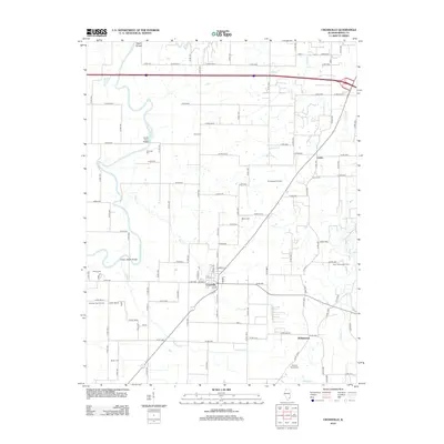
2012 Map of Crossville
USGS Topo · Published 2012About this map
The Little Wabash River defines the western edge of this territory, where the Hanks Ferry Bridge and Cherry Shoals Bridge provide vital crossings. The village of Crossville serves as the central hub, surrounded by a landscape marked by both agriculture and industry. To the east and south, the Phillipstown Oil Field, New Harmony Oil Field, and Sumpter East Oil Field indicate the importance of energy extraction in this region of White County.
Find a feature on this map
90 named features on this map. Tap any name to fly to it.
Don’t see what you’re looking for? This feature index may not catch every label — zoom into the map to look around manually.
Map Details
Editions of this 2012 Crossville Map
This is the sole edition of this map. No revisions or reprints were ever made.
Other maps of this area

1903 · New Harmony
USGS Topo · 1:62,500

1903 · Patoka
USGS Topo · 1:125,000

1904 · Mount Carmel
USGS Topo · 1:62,500

1938 · New Harmony
USGS Topo · 1:62,500

1940 · Carmi
USGS Topo · 1:62,500

1943 · Carmi
USGS Topo · 1:62,500

1943 · Albion
USGS Topo · 1:62,500

1946 · Albion
USGS Topo · 1:62,500

1956 · Vincennes
USGS Topo · 1:250,000

1957 · Vincennes
USGS Topo · 1:250,000