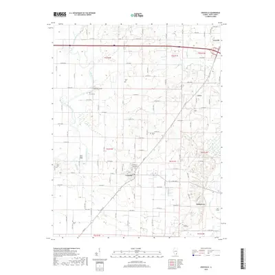
2018 Map of Crossville
USGS Topo · Published 2018About this map
Little Wabash River meanders across the western half of this White County landscape, its course marked by historical crossings like Hanks Ferry Bridge and Cherry Shoals Bridge. The settlement of Crossville serves as a central hub, where the intersection of S Cross St and E Main St anchors a grid of local roads extending into the surrounding farmland. To the northeast, the town of Grayville sits near the winding path of French Cr, while smaller communities such as Calvin and Phillipstown are situated along the eastern reaches near Fox Island. This 2018 survey provides a clear view of the rural cemetery network essential for genealogical research, including the Whiting Family Cem, Riverside Cem, and Union Cem. The terrain is defined by the drainages of Elliott Cr and Crooked Cr, which influence the placement of the township and range boundaries that have organized this Illinois territory for generations.
Find a feature on this map
83 named features on this map. Tap any name to fly to it.
Don’t see what you’re looking for? This feature index may not catch every label — zoom into the map to look around manually.
Map Details
Editions of this 2018 Crossville Map
This is the sole edition of this map. No revisions or reprints were ever made.
Other maps of this area

1903 · New Harmony
USGS Topo · 1:62,500

1903 · Patoka
USGS Topo · 1:125,000

1904 · Mount Carmel
USGS Topo · 1:62,500

1938 · New Harmony
USGS Topo · 1:62,500

1940 · Carmi
USGS Topo · 1:62,500

1943 · Carmi
USGS Topo · 1:62,500

1943 · Albion
USGS Topo · 1:62,500

1946 · Albion
USGS Topo · 1:62,500

1956 · Vincennes
USGS Topo · 1:250,000

1957 · Vincennes
USGS Topo · 1:250,000