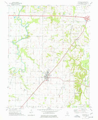
1974 Map of Crossville
USGS Topo · Published 1977About this map
Crossville sits at the intersection of a sprawling petroleum landscape and traditional agricultural bottomlands in White County. The mid-1970s environment is heavily shaped by the Albion Oil Field to the north and the Phillipstown Oil Field to the south, with numerous oil wells dotting the township lines of Phillips and Gray. This industrial activity contrasts with the winding course of the Little Wabash River, where historic crossings like Hanks Ferry Bridge and Cherry Shoals Bridge link the riverbanks. Local genealogy is well-represented through numerous rural houses of worship and burial grounds, including Stokes Chapel, Bethel Church, and the Riverside Cemetery. The Penn Central railroad cuts diagonally across the quadrangle, serving the village of Calvin and the larger hub at Crossville, while the low-lying east is defined by the Main Ditch and the Fox River near Phillipstown.
Find a feature on this map
37 named features on this map. Tap any name to fly to it.
Don’t see what you’re looking for? This feature index may not catch every label — zoom into the map to look around manually.
Map Details
Editions of this 1974 Crossville Map
This is the sole edition of this map. No revisions or reprints were ever made.
Other maps of this area

1903 · New Harmony
USGS Topo · 1:62,500

1903 · Patoka
USGS Topo · 1:125,000

1904 · Mount Carmel
USGS Topo · 1:62,500

1938 · New Harmony
USGS Topo · 1:62,500

1940 · Carmi
USGS Topo · 1:62,500

1943 · Carmi
USGS Topo · 1:62,500

1943 · Albion
USGS Topo · 1:62,500

1946 · Albion
USGS Topo · 1:62,500

1956 · Vincennes
USGS Topo · 1:250,000

1957 · Vincennes
USGS Topo · 1:250,000