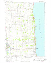
1963 Map of Croswell
USGS Topo · Published 1977About this map
The Black River corridor and the shores of Lake Huron anchor this mid-century survey of eastern Sanilac County. The city of Croswell sits at a strategic bend in the river, showing its industrial and civic core with the Fairground, a local Cemetery, and the Chesapeake and Ohio railroad line running north-south through the village center. To the east, the lakeside village of Lexington serves as a hub for summer activity, bordered by a series of camps such as Camp Rankin, Camp Cavell, and Camp Stapleton that line the lakefront bluffs.
Find a feature on this map
47 named features on this map. Tap any name to fly to it.
Don’t see what you’re looking for? This feature index may not catch every label — zoom into the map to look around manually.
Map Details
Editions of this 1963 Croswell Map
2 editions found
Other maps of this area

1954 · Flint
USGS Topo · 1:250,000

1958 · Flint
USGS Topo · 1:250,000

1961 · Roseburg
USGS Topo · 1:24,000
1961 · Jeddo
USGS Topo · 1:24,000

1963 · Croswell
USGS Topo · 1:24,000

1963 · Port Sanilac
USGS Topo · 1:24,000

1963 · Applegate
USGS Topo · 1:24,000
1963 · Carsonville
USGS Topo · 1:24,000

1984 · Croswell
USGS Topo · 1:100,000
2011 · Jeddo OE E
USGS Topo · 1:24,000