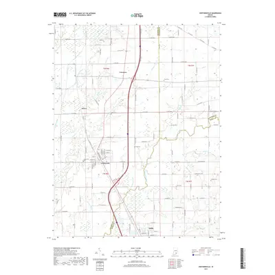
2019 Map of Crothersville
USGS Topo · Published 2019About this map
Crothersville and Austin anchor this southern Indiana corridor, where the landscape is defined by an intricate network of managed waterways. The agricultural character of the region is evident in the numerous drainage systems, such as Rider Ditch, Bedel Ditch, and Blau Ditch, which channel water toward the Vernon Fork Muscatatuck River. Smaller settlements like Uniontown and Retreat remain connected by a dense grid of county roads that reflect the late 19th-century land division patterns common in the Midwest.
Find a feature on this map
114 named features on this map. Tap any name to fly to it.
Don’t see what you’re looking for? This feature index may not catch every label — zoom into the map to look around manually.
Map Details
Editions of this 2019 Crothersville Map
This is the sole edition of this map. No revisions or reprints were ever made.
Other maps of this area

1947 · Scottsburg
USGS Topo · 1:24,000

1956 · Blocher
USGS Topo · 1:24,000

1956 · Deputy
USGS Topo · 1:24,000

1956 · Louisville
USGS Topo · 1:250,000

1958 · Little York
USGS Topo · 1:24,000

1958 · Seymour
USGS Topo · 1:24,000

1959 · Tampico
USGS Topo · 1:24,000
1959 · Hayden
USGS Topo · 1:24,000

1959 · Crothersville
USGS Topo · 1:24,000
1959 · Chestnut Ridge
USGS Topo · 1:24,000