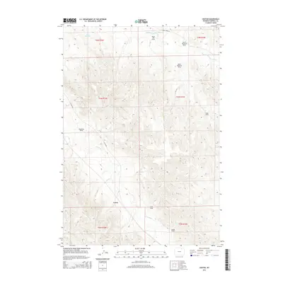
2015 Map of Croton
USGS Topo · Published 2015About this map
Wild Horse Cr and its northern tributary, Middle Prong Wild Horse Cr, define the drainage patterns of this Campbell County landscape. The settlement of Croton sits at the southern reach of the quadrangle, serving as a focal point for the surrounding ranching and range land. The terrain is deeply incised by a series of named coulees and drainage ways, including Black Bill Draw, Deadman Draw, and Cedar Draw, which reflect the historical reliance on seasonal water sources in this arid region.
Find a feature on this map
19 named features on this map. Tap any name to fly to it.
Don’t see what you’re looking for? This feature index may not catch every label — zoom into the map to look around manually.
Map Details
Editions of this 2015 Croton Map
This is the sole edition of this map. No revisions or reprints were ever made.
Other maps of this area

1954 · Gillette
USGS Topo · 1:250,000

1955 · Sheridan
USGS Topo · 1:250,000

1955 · Gillette
USGS Topo · 1:250,000

1958 · Gillette
USGS Topo · 1:250,000

1958 · Sheridan
USGS Topo · 1:250,000

1962 · Gillette
USGS Topo · 1:250,000

1962 · Sheridan
USGS Topo · 1:250,000

1971 · Larey Draw
USGS Topo · 1:24,000
1971 · Spotted Horse
USGS Topo · 1:24,000
1971 · Arvada NE
USGS Topo · 1:24,000