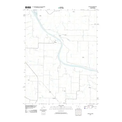
2010 Map of Croton
USGS Topo · Published 2010About this map
The Des Moines River winds through the heart of this borderland landscape between Iowa and Missouri, anchoring small riverside settlements like Croton and Athens. The terrain is deeply etched by a network of drainage systems, including Lick Creek and Cedar Creek, which flow into the larger river valley. For those researching local history or genealogy, the map identifies a high density of rural burial sites, ranging from the Pioneer Cemetery and Salubria Cemetery in the north to the Northrup Cemetery and Peaksville Cemetery near the southern Missouri boundary. The rectilinear road grid, marked by thoroughfares such as Belfast Rd and River Rd, contrasts with the meandering paths of Dumas Creek and Crooked Creek, illustrating how the agricultural layout of the 21st century fits around the natural geography of the river bluffs.
Find a feature on this map
33 named features on this map. Tap any name to fly to it.
Don’t see what you’re looking for? This feature index may not catch every label — zoom into the map to look around manually.
Map Details
Editions of this 2010 Croton Map
This is the sole edition of this map. No revisions or reprints were ever made.
Other maps of this area

1903 · Kahoka
USGS Topo · 1:125,000

1949 · Wayland
USGS Topo · 1:24,000

1949 · Kahoka
USGS Topo · 1:24,000

1950 · Kahoka
USGS Topo · 1:24,000

1950 · Wayland
USGS Topo · 1:24,000

1950 · Medill
USGS Topo · 1:24,000

1951 · Medill
USGS Topo · 1:24,000

1958 · Burlington
USGS Topo · 1:250,000

1961 · Burlington
USGS Topo · 1:250,000

1963 · Burlington
USGS Topo · 1:250,000