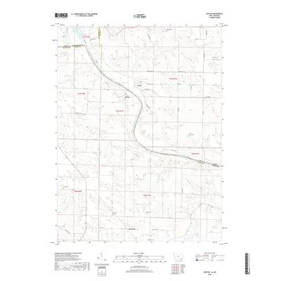
2018 Map of Croton
USGS Topo · Published 2018About this map
The Des Moines River winds through this borderland region, serving as the natural boundary between Iowa and Missouri. Along its northern banks, the settlement of Croton and the riverside community of Athens occupy a landscape defined by sharp elevation changes and numerous creek drainages. The area is a significant site for genealogists, as it preserves the locations of numerous small family and community burial grounds including Salubria Cem, Pioneer Cem, and Walker Cem.
Find a feature on this map
48 named features on this map. Tap any name to fly to it.
Don’t see what you’re looking for? This feature index may not catch every label — zoom into the map to look around manually.
Map Details
Editions of this 2018 Croton Map
This is the sole edition of this map. No revisions or reprints were ever made.
Other maps of this area

1903 · Kahoka
USGS Topo · 1:125,000

1949 · Wayland
USGS Topo · 1:24,000

1949 · Kahoka
USGS Topo · 1:24,000

1950 · Kahoka
USGS Topo · 1:24,000

1950 · Wayland
USGS Topo · 1:24,000

1950 · Medill
USGS Topo · 1:24,000

1951 · Medill
USGS Topo · 1:24,000

1958 · Burlington
USGS Topo · 1:250,000

1961 · Burlington
USGS Topo · 1:250,000

1963 · Burlington
USGS Topo · 1:250,000