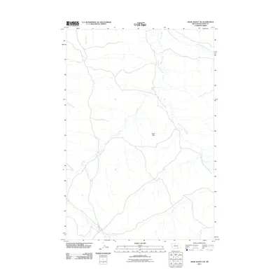
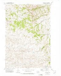
2011 Map of Crow Agency NE
USGS Topo · Published 2011About this map
Eagle Butte stands as a prominent landmark in this drainage-rich portion of Big Horn County, Montana. The landscape is defined by the complex convergence of several waterways, including the main channel of Tullock Creek and its significant tributaries, the West Fork Tullock Creek and East Fork Tullock Creek. These winding watercourses dictate the local topography, carving out the terrain alongside Ash Creek and Little Dry Creek. In this sparsely developed area, Sarpy Rd provides one of the few primary transportation routes, navigating the spaces between the various creek beds and Dawes Creek. This 2011 survey by the U.S. Geological Survey offers a clear view of the natural water distribution and the relationship between these essential creek forks and the higher ground of the buttes.
Find a feature on this map
8 named features on this map. Tap any name to fly to it.
Don’t see what you’re looking for? This feature index may not catch every label — zoom into the map to look around manually.
Map Details
Editions of this 2011 Crow Agency NE Map
This is the sole edition of this map. No revisions or reprints were ever made.
Other maps of this area

1954 · Hardin
USGS Topo · 1:250,000

1957 · Hardin
USGS Topo · 1:250,000

1958 · Hardin
USGS Topo · 1:250,000

1967 · Jeans Fork NW
USGS Topo · 1:24,000

1967 · Crow Agency NE
USGS Topo · 1:24,000

1967 · Crow Agency SE
USGS Topo · 1:24,000
1967 · Crow Agency
USGS Topo · 1:24,000
1967 · Little Dry Creek
USGS Topo · 1:24,000
1967 · Jeans Fork SW
USGS Topo · 1:24,000
1972 · The Dugout
USGS Topo · 1:24,000