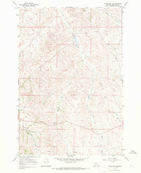
1967 Map of Jeans Fork SW
USGS Topo · Published 1971About this map
The Crow Indian Reservation provides the cultural and geographic context for this mid-century survey of Big Horn County. The landscape is defined by the branching tributaries of the Tullock drainage, including the West Fork Tullock Creek and Middle Fork Tullock Creek. The terrain is characterized by intricate contouring that reveals a complex system of ridges and coulees, where water sources were critical for land use. Specific points of interest include several isolated Spring sites and Springs, as well as a Well located in the western portion of the quadrangle. Other drainage systems such as Blue Creek, Dipping Vat Creek, and the North Fork Reno Creek illustrate the natural runoff patterns of this high-plains environment during the late 1960s.
Find a feature on this map
8 named features on this map. Tap any name to fly to it.
Don’t see what you’re looking for? This feature index may not catch every label — zoom into the map to look around manually.
Map Details
Editions of this 1967 Jeans Fork SW Map
This is the sole edition of this map. No revisions or reprints were ever made.
Other maps of this area

1894 · Rosebud
USGS Topo · 1:125,000

1901 · Rosebud
USGS Topo · 1:125,000

1954 · Hardin
USGS Topo · 1:250,000

1957 · Hardin
USGS Topo · 1:250,000

1958 · Hardin
USGS Topo · 1:250,000

1967 · Jeans Fork NW
USGS Topo · 1:24,000

1967 · Jeans Fork NE
USGS Topo · 1:24,000

1967 · Crow Agency NE
USGS Topo · 1:24,000

1967 · Crow Agency SE
USGS Topo · 1:24,000

1967 · Lodge Grass NE
USGS Topo · 1:24,000