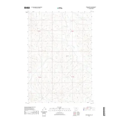
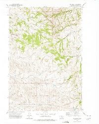
2020 Map of Crow Agency NE
USGS Topo · Published 2020About this map
Eagle Butte rises as a central landmark in this Big Horn County landscape, where the drainage systems of Tullock Cr and Ash Cr define the rugged topography. The survey details a complex network of seasonal and perennial waterways, including the W Fork Tullock Cr and E Fork Tullock Cr, which have historically shaped the grazing and settlement patterns of this Montana region. These creek beds serve as critical reference points for land boundaries within t1s r35e and neighboring townships. While the area is largely characterized by its natural features rather than dense settlements, the map provides precise locations for Little Dry Cr and Dawes Cr, offering essential data for genealogists and researchers tracing historic land claims and environmental history in the Crow Agency vicinity.
Find a feature on this map
12 named features on this map. Tap any name to fly to it.
Don’t see what you’re looking for? This feature index may not catch every label — zoom into the map to look around manually.
Map Details
Editions of this 2020 Crow Agency NE Map
This is the sole edition of this map. No revisions or reprints were ever made.
Other maps of this area

1954 · Hardin
USGS Topo · 1:250,000

1957 · Hardin
USGS Topo · 1:250,000

1958 · Hardin
USGS Topo · 1:250,000

1967 · Jeans Fork NW
USGS Topo · 1:24,000

1967 · Crow Agency NE
USGS Topo · 1:24,000

1967 · Crow Agency SE
USGS Topo · 1:24,000
1967 · Crow Agency
USGS Topo · 1:24,000
1967 · Little Dry Creek
USGS Topo · 1:24,000
1967 · Jeans Fork SW
USGS Topo · 1:24,000
1972 · The Dugout
USGS Topo · 1:24,000