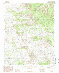
1985 Map of Crow Mesa West
USGS Topo · Published 1985About this map
Crow Mesa dominates this high-desert landscape in the mid-1980s, rising between deep-cut drainages in Northwest New Mexico. The small community of Nageezi sits along the western edge, serving as a landmark near the wide, sandy bed of Blanco Wash. To the south, the settlement of Kimbeto marks the area near Kimbeto Wash, highlighting the sparse but vital settlement pattern tied to the region's geography.
Find a feature on this map
12 named features on this map. Tap any name to fly to it.
Don’t see what you’re looking for? This feature index may not catch every label — zoom into the map to look around manually.
Map Details
Editions of this 1985 Crow Mesa West Map
This is the sole edition of this map. No revisions or reprints were ever made.
Other maps of this area

1889 · Largo
USGS Topo · 1:250,000

1895 · Largo
USGS Topo · 1:250,000

1954 · Aztec
USGS Topo · 1:250,000

1958 · Aztec
USGS Topo · 1:250,000

1959 · Nageezi
USGS Topo · 1:62,500

1962 · Aztec
USGS Topo · 1:250,000

1965 · Aztec
USGS Topo · 1:250,000

1966 · Lybrook NW
USGS Topo · 1:24,000
1966 · Lybrook
USGS Topo · 1:24,000
1966 · Blanco Trading Post
USGS Topo · 1:24,000