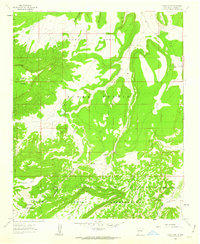
1961 Map of Crow Point
USGS Topo · Published 1963About this map
The Acoma Pueblo Indian Reservation and the adjacent Acoma Purchase dominate this early 1960s landscape, characterized by high mesas and deep drainage systems. The topography is defined by massive formations like Sandstone Mesa and the expansive Cebolleta Mesa, while Cañon Largo serves as a primary geographical artery through the territory. This map reveals a land utilized through traditional travel and basic access, where travel is limited to a Pack Trail or a Jeep Trail winding through the high desert.
Find a feature on this map
20 named features on this map. Tap any name to fly to it.
Don’t see what you’re looking for? This feature index may not catch every label — zoom into the map to look around manually.
Map Details
Editions of this 1961 Crow Point Map
2 editions found
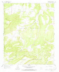
Other maps of this area

1883 · Mt. Taylor
USGS Topo · 1:250,000

1886 · Mt. Taylor
USGS Topo · 1:250,000

1892 · Mt. Taylor
USGS Topo · 1:250,000

1899 · Mt. Taylor
USGS Topo · 1:250,000

1917 · Broom Mountain
USGS Topo · 1:125,000

1954 · Socorro
USGS Topo · 1:250,000

1957 · Grants SE
USGS Topo · 1:24,000

1957 · Mc Cartys
USGS Topo · 1:24,000

1957 · Cubero
USGS Topo · 1:24,000

1958 · Socorro
USGS Topo · 1:250,000