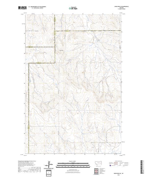
2024 Map of Crow Rock SE
USGS Topo · Published 2024About this map
Chalk Butte stands as a prominent local landmark in this sparsely settled corner of Eastern Montana where four counties — Garfield, Prairie, Custer, and Rosebud — converge. The landscape is defined by the drainage networks of Wolf Creek in the north and the meandering Crow Rock Creek, which carves through the central terrain before being joined by several ephemeral tributaries. The transition between these drainage basins reveals a rugged topography of ridges and draws typical of the Missouri Plateau.
Find a feature on this map
17 named features on this map. Tap any name to fly to it.
Don’t see what you’re looking for? This feature index may not catch every label — zoom into the map to look around manually.
Map Details
Editions of this 2024 Crow Rock SE Map
This is the sole edition of this map. No revisions or reprints were ever made.
Other maps of this area

1953 · Miles City
USGS Topo · 1:250,000

1954 · Forsyth
USGS Topo · 1:250,000

1957 · Miles City
USGS Topo · 1:250,000

1957 · Forsyth
USGS Topo · 1:250,000

1958 · Miles City
USGS Topo · 1:250,000

1958 · Forsyth
USGS Topo · 1:250,000

1965 · Rock Springs School
USGS Topo · 1:24,000

1965 · Little Chalk Butte
USGS Topo · 1:24,000

1965 · Twin Buttes School
USGS Topo · 1:24,000
1965 · Combs Ranch
USGS Topo · 1:24,000