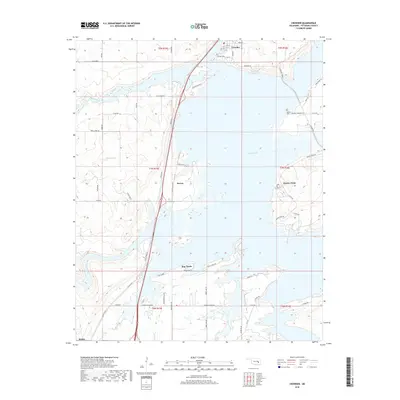
2018 Map of Crowder
USGS Topo · Published 2018About this map
Eufaula Lake dominates this 2018 landscape in Pittsburg County, surrounding the town of Crowder with its intricate inlets and flooded creek valleys. The map illustrates how modern transportation infrastructure, led by the north-south corridor of Hooser Rd, negotiates the complex shoreline and various peninsulas like Massey Point. Moving south from the larger settlement of Crowder, the terrain is punctuated by smaller localities including Reams, Bug Tussle, and Mekko. Genealogists will find the locations of Crowder Cem and Massey Cem clearly marked relative to the surrounding road network. The hydrologic patterns of the region are defined by Rock Creek, Wildhorse Cr, and Coal Creek, which feed into the primary reservoir, creating a distinct blend of rural Oklahoma settlements and extensive water-access points.
Find a feature on this map
63 named features on this map. Tap any name to fly to it.
Don’t see what you’re looking for? This feature index may not catch every label — zoom into the map to look around manually.
Map Details
Editions of this 2018 Crowder Map
This is the sole edition of this map. No revisions or reprints were ever made.
Other maps of this area

1898 · McAlester
USGS Topo · 1:125,000

1900 · Canadian
USGS Topo · 1:125,000

1909 · Mc Alester
USGS Topo · 1:125,000

1946 · Fort Smith
USGS Topo · 1:250,000

1950 · Mcalester
USGS Topo · 1:250,000

1962 · McAlester
USGS Topo · 1:250,000

1965 · Fort Smith
USGS Topo · 1:250,000

1965 · McAlester
USGS Topo · 1:250,000

1967 · Fort Smith
USGS Topo · 1:250,000

1967 · Krebs
USGS Topo · 1:24,000