
1967 Map of Krebs
USGS Topo · Published 1968About this map
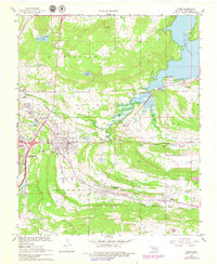
Krebs and its surrounding coal-country settlements define this late 1960s landscape in Pittsburg County. The dense grid of McAlester reaches the western edge, while smaller communities like Alderson, Bache, Richville, and Carbon are scattered along the major transportation corridors. The regional economy of the era is evident in the heavy rail infrastructure of the Missouri Kansas Texas and the Chicago Rock Island and Pacific railroads, which parallel the towns and link them to various Quarries and a Gas Well.
Find a feature on this map
41 named features on this map. Tap any name to fly to it.
Don’t see what you’re looking for? This feature index may not catch every label — zoom into the map to look around manually.
Map Details
Editions of this 1967 Krebs Map
2 editions found
Other maps of this area

1898 · McAlester
USGS Topo · 1:125,000

1900 · Canadian
USGS Topo · 1:125,000

1909 · Mc Alester
USGS Topo · 1:125,000

1946 · Fort Smith
USGS Topo · 1:250,000

1950 · Mcalester
USGS Topo · 1:250,000

1962 · McAlester
USGS Topo · 1:250,000

1965 · Fort Smith
USGS Topo · 1:250,000

1965 · McAlester
USGS Topo · 1:250,000

1967 · Fort Smith
USGS Topo · 1:250,000
1967 · Mc Alester
USGS Topo · 1:24,000