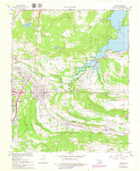
1967 Map of Krebs
USGS Topo · Published 1978About this map
The railroad community of Krebs serves as a central hub in this late 1960s study of Pittsburg County, where the industrial influence of the Chicago Rock Island and Pacific and the Missouri Kansas Texas railroads is clearly visible. These rail lines define the movement of goods and people between smaller settlements like Alderson, Bache, and Carbon. To the east, the rising waters of Eufaula Lake begin to dominate the landscape, contrasting with the inland terrain marked by Pine Knob and Bald Knob.
Find a feature on this map
43 named features on this map. Tap any name to fly to it.
Don’t see what you’re looking for? This feature index may not catch every label — zoom into the map to look around manually.
Map Details
Editions of this 1967 Krebs Map
2 editions found
Other maps of this area

1898 · McAlester
USGS Topo · 1:125,000

1900 · Canadian
USGS Topo · 1:125,000

1909 · Mc Alester
USGS Topo · 1:125,000

1946 · Fort Smith
USGS Topo · 1:250,000

1950 · Mcalester
USGS Topo · 1:250,000

1962 · McAlester
USGS Topo · 1:250,000

1965 · Fort Smith
USGS Topo · 1:250,000

1965 · McAlester
USGS Topo · 1:250,000

1967 · Fort Smith
USGS Topo · 1:250,000

1967 · Krebs
USGS Topo · 1:24,000