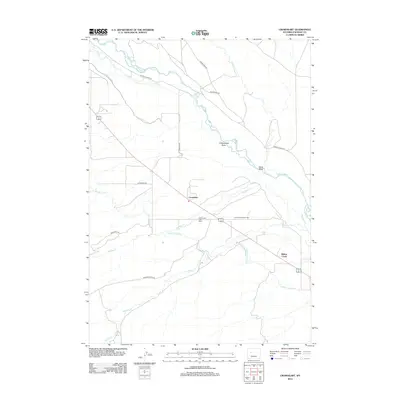
2012 Map of Crowheart
USGS Topo · Published 2012About this map
Crowheart serves as the central settlement in this high-altitude landscape where the Wind River and its complex network of irrigation infrastructure define the local geography. The map reveals an intricate system of water management essential for high-desert life, including the Wind River Canal, Dry Creek Canal, and Meadow Creek Canal. These man-made features cut across the terrain alongside natural drainages like Cottonwood Draw and Kane Draw.
Find a feature on this map
24 named features on this map. Tap any name to fly to it.
Don’t see what you’re looking for? This feature index may not catch every label — zoom into the map to look around manually.
Map Details
Editions of this 2012 Crowheart Map
This is the sole edition of this map. No revisions or reprints were ever made.
Other maps of this area

1951 · Bull Lake East
USGS Topo · 1:24,000

1952 · Wilderness
USGS Topo · 1:24,000

1952 · Crowheart Butte
USGS Topo · 1:24,000

1952 · Crowheart NW
USGS Topo · 1:24,000

1952 · Crowheart NE
USGS Topo · 1:24,000

1952 · Bull Lake West
USGS Topo · 1:24,000

1952 · Crowheart
USGS Topo · 1:24,000

1952 · Burris
USGS Topo · 1:24,000

1952 · Kirkland Park
USGS Topo · 1:24,000

1955 · Thermopolis
USGS Topo · 1:250,000