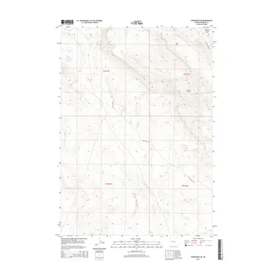
2015 Map of Crowheart NE
USGS Topo · Published 2015About this map
Rolff Lake and the drainage network of the Wind River Basin define this high plains landscape in Fremont County. The terrain is characterized by a series of prominent draws, including the mineral-suggestive Coal Draw and Maverick Spring Draw, which reveal the erosional patterns and geological history of the region. Transportation across these plains is facilitated by historic routes such as Maverick Springs Rd and Sheldon Dome Rd, which connect the scattered resource-rich areas of the territory. The map illustrates the classic Public Land Survey System grid across Townships 5 and 6 North, showing how section lines and range boundaries were imposed upon the natural flow of Red Cr and Dry Cr. This 2015 survey provides a clear look at the intersection of infrastructure and topography in a part of Wyoming shaped by ranching and resource extraction.
Find a feature on this map
12 named features on this map. Tap any name to fly to it.
Don’t see what you’re looking for? This feature index may not catch every label — zoom into the map to look around manually.
Map Details
Editions of this 2015 Crowheart NE Map
This is the sole edition of this map. No revisions or reprints were ever made.
Other maps of this area

1904 · Kirwin
USGS Topo · 1:125,000

1906 · Kirwin
USGS Topo · 1:125,000

1951 · Lookout Butte SW
USGS Topo · 1:24,000

1951 · Maverick Spring
USGS Topo · 1:24,000

1952 · Antelope Ridge
USGS Topo · 1:24,000

1952 · Crowheart Butte
USGS Topo · 1:24,000

1952 · Crowheart NW
USGS Topo · 1:24,000

1952 · Crowheart NE
USGS Topo · 1:24,000

1952 · Crowheart
USGS Topo · 1:24,000

1955 · Thermopolis
USGS Topo · 1:250,000